Presentation Tools
196.0K views | +0 today
Follow
Presentation Tools
Tools and services to deliver your presentations: online and off
Curated by Robin Good
Your new post is loading...
Scooped by Robin Good
March 8, 2012 11:32 AM
Scoop.it!

Create Professional Thematic Maps from Geographic Data: Indiemapper

Create Professional Thematic Maps from Geographic Data: Indiemapper | Presentation Tools | Scoop.it

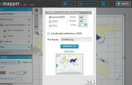
Robin Good: Indiemapper is a web-based application that allows you to create static, thematic maps from geographic data by bringing the best of traditional cartographic design to internet map-making.


It requires no login or registration and you can start to use it immediately. 


Images can be exported in a variety of formats, including layered SVG, PNG, JPG an editable AI (Adobe Illustrator) formats.


Free to use.


Try it out now: http://indiemapper.com/ 

No comment yet.
Scooped by Robin Good
January 26, 2012 3:15 PM
Scoop.it!

Create Custom Professional Data-Maps: TargetMap

Robin Good: TargetMap is a free web service that allows you to create and customize professional-looking data-maps with any country or area in the world. 


Maps created with TargetMap (satellite, physical, hybrid, etc:) can utilize excel-formatted data, can be color-coded and customized manually, or specific data can be input in them. 


The user can also leverage existing public maps for the creation and customization of new ones. 


Final maps can be exported as images, embedded in your web site or blog or shared directly to Facebook and Twitter.


Three options are available for your maps: shareable, not shareable and private/business. The first two options are free and the third one starts at $49/month.


Free shareable maps do not support the zip code field. 


Find out more: http://www.targetmap.com/ 

No comment yet.